Wildfire exposure and burn scars
Past fires, burned area and recovery near your assets.
- DATA
- Sentinel-2, fire perimeters
- OUTPUTS
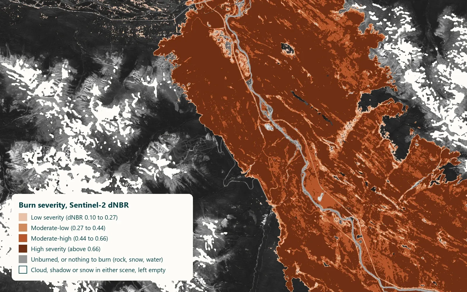
- Burn scars, exposure map, report
- TYPICAL TIME
- After each fire season
What you can do with it
- 01Map burned area and severity after a fire
- 02Track how vegetation returns, year by year
- 03See which assets sit close to fire-prone land
- 04Document exposure for underwriting or planning
METHOD
How it is made
Every number names its data and its limits.
- DATA USED
- Sentinel-2 before and after each fire; published fire perimeters where available.
- METHOD OR MODEL
- Burn index difference (dNBR) classed into severity; recovery tracked as the index returns toward pre-fire values. Exposure from distance to fire-prone cover and past fires.
- ACCURACY AS MEASURED
- Severity classes checked against published perimeters and any field reports you hold; measured on your data during discovery.
- WHAT THIS DOES NOT TELL YOU
- Smoke and cloud delay the post-fire image. Severity from satellite is a vegetation measure, not a structure-damage assessment.
- LANGUAGES
- English and French
WHAT YOU RECEIVE
Maps and data in your formats
- Burn scar and severity GeoTIFF
- Recovery time series (CSV)
- Exposure GeoPackage
- PDF report
WHAT WE NEED FROM YOU
- Your assets or area of interest
- Fire dates or perimeters, if you have them
- What exposure means for you: distance, frequency, severity
WHAT WE PREPARE
- Before/after scene pairs
- Severity and recovery maps
- Exposure layer around your assets
- Report
Steps and time
- Discovery3–4 weeksOne fire mapped end to end, exposure method agreed
- Build2–3 weeksPipeline for your region
- RunYearlyUpdate after each fire season
DISCUSS THIS SOLUTION
Tell us about your area
We reply with a first view on whether this fits, and what discovery would cover.